
Файл:BeringBridge.jpg
Не е налична версия с по-висока разделителна способност.
BeringBridge.jpg (700 × 454 пиксела, големина на файла: 78 КБ, MIME-тип: image/jpeg)
| Този файл е от Общомедия и може да се използва от други проекти.
Следва информация за файла, достъпна през оригиналната му описателна страница. |
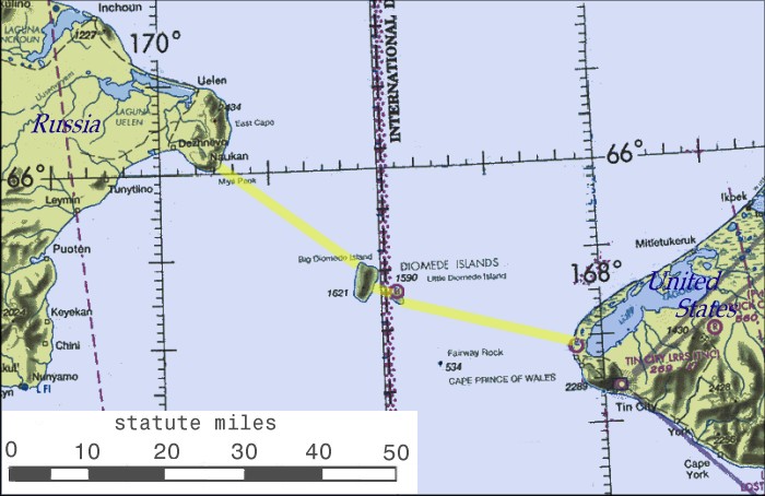
| Описание |
English: Possible routing of International Peace Bridge |
||||||
| Източник | Source of basemap: World Aeronautical Chart CC-8, Federal Aviation Administration | ||||||
| Автор | Cleaned up and annotated by contributor. | ||||||
| Права (Повторно използване на файла) |
|
||||||


|
Това изображение (или всички изображения в тази страница/категория) би трябвало да бъдат пресъздадени с използване на векторна графика във формат SVG. Това има няколко предимства; вижте Commons:Media for cleanup за повече информация. Ако разполагате с това избражение в SVG формат, моля качете го. След това заместете този шаблон с {{Vector version available|име на новия файл.svg}}.
|


История на файла
Избирането на дата/час ще покаже как е изглеждал файлът към онзи момент.
| Дата/Час | Миникартинка | Размер | Потребител | Коментар | |
|---|---|---|---|---|---|
| текуща | 16:52, 7 януари 2007 | | 700 × 454 (78 КБ) | Toyota prius 2~commonswiki | == Summary == Possible routing of International Peace Bridge. Source of basemap: World Aeronautical Chart CC-8, Federal Aviation Administration. Cleaned up and annotatated by contributor. == Licensing == {{PD-USGov}} |
Използване на файла
Следните 2 страници използват следния файл:
Глобално използване на файл
Този файл се използва от следните други уикита:
- Употреба в ca.wikipedia.org
- Употреба в en.wikipedia.org
- Употреба в eo.wikipedia.org
- Употреба в es.wikipedia.org
- Употреба в fa.wikipedia.org
- Употреба в fr.wikipedia.org
- Употреба в he.wikipedia.org
- Употреба в hu.wikipedia.org
- Употреба в id.wikipedia.org
- Употреба в it.wikipedia.org
- Употреба в nl.wikipedia.org
- Употреба в pl.wikipedia.org
- Употреба в pnb.wikipedia.org
- Употреба в pt.wikipedia.org
- Употреба в ru.wikipedia.org
- Употреба в sl.wikipedia.org
- Употреба в sq.wikipedia.org
- Употреба в sv.wikipedia.org
- Употреба в tr.wikipedia.org
- Употреба в uk.wikipedia.org
- Употреба в ur.wikipedia.org
- Употреба в www.wikidata.org
- Употреба в zh.wikipedia.org